NASA
Jet Propulsion Laboratory
California Institute of Technology
Skip Navigation
Ocean Surface Topography from Space
Stay Connected
menu
close modal
Resources
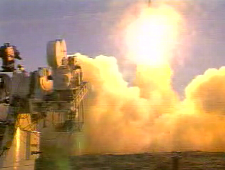
Jason-1 launch images
Published:
September 13, 2010
Jason-1 launch images
ENLARGE
Related
Spacecraft processing
Sentinel-6 Michael Freilich spacecraft processing
Jason-3 Ready for Launch
Jason-3 Ready for Launch
Watch the Jason-3 Science Briefing from Friday, Jan 15, 2016 - panelists discussed the science and research of the Jason-3 mission.
The Science of Jason-3
Jason-1 on top of the DPAF
Jason-1 on top of the DPAF
The joint U.S.-European Sentinel-6 Michael Freilich is the next in a line of Earth-observing satellites that will collect the most accurate data yet on sea level and how it changes over time. With ...
New U.S.-European Satellite Tracking Sea Level Rise
Recorded live broadcast of Sentinel-6B, launched at 9:21 p.m. PST, Sunday, Nov. 16 (12:21 a.m. EST, Monday, Nov. 17) aboard a SpaceX Falcon 9 rocket from Vandenberg Space Force Base in California.
Relive the Launch: Sentinel-6B
Early morning at the launch pad
Early morning at the launch pad
For NASA scientist Severine Fournier, studying our planet knows no borders.
"Science is International" Says French Sea Level Rise NASA Scientist
High Resolution Jason-1 launch images
High Resolution Jason-1 launch images
SpaceX Falcon 9 rocket with the Sentinel-6 Michael Freilich satellite is lifted to vertical at Space Launch Complex 4
Sentinel-6 on pad at SLC-4, VAFB
Jason-1 Radiometer
Jason-1 Radiometer
OSTM/Jason-2 Radiometer Antenna
OSTM/Jason-2 Radiometer Antenna
Jason-1 atop the Delta II Photo: Tom Shain
Jason-1 atop the Delta II Photo: Tom Shain
Radiometer Install - Jan. 2007
Radiometer Install - Jan. 2007
The SpaceX Falcon 9 rocket carrying the Sentinel-6 Michael Freilich spacecraft lifts off from Space Launch Complex 4 at Vandenberg Air Force Base in California, Nov. 21, 2020, at 9:17 a.m. PST
Sentinel-6 Launch
Sentinel-6 Michael Freilich Launch footage
Sentinel-6 Michael Freilich Launch Footage
These photos were taken during the Payload Attach Fitting (PAF) mating operation with Jason-1. (11/14/01) Photos: Scott Michel
These photos were taken during the Payload Attach Fitting (PAF) mating operation with Jason-1. (11/14/01) Photos: Scott Michel
TOPEX/Poseidon Line Drawing
TOPEX/Poseidon Line Drawing
Water Vapor
Water Vapor
Sea Level
Sea Level
Jason-3 3D Model
Jason-3 3D Model
TOPEX/Poseidon Ground Tracks
TOPEX/Poseidon Ground Tracks
TOPEX/Poseidon Altimeter
TOPEX/Poseidon Altimeter
Radiometer Install - April 2007
Radiometer Install - April 2007
Jason-3 on the Launch Pad
Jason-3 on the Launch Pad