NASA
Jet Propulsion Laboratory
California Institute of Technology
Skip Navigation
Ocean Surface Topography from Space
Stay Connected
menu
close modal
Resources
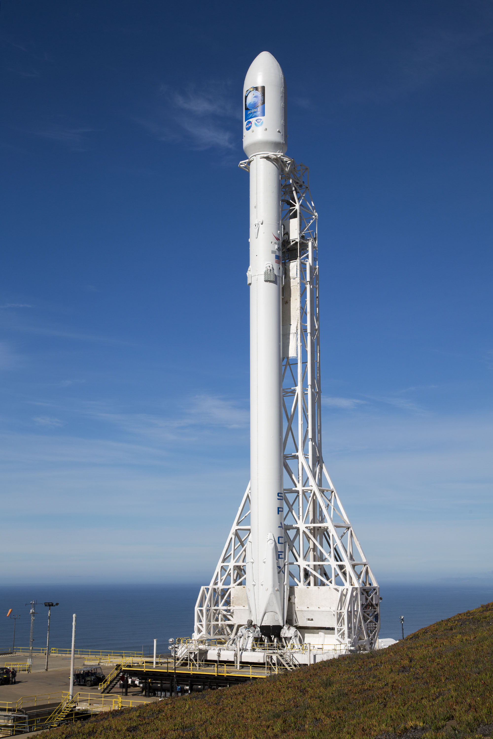
Jason-3 on the Launch Pad
Published:
January 17, 2016
Jason-3 on the Launch Pad
ENLARGE
Related
Launch preparations are progressing! (11/21/01) Photos: Stacy Mitchell of John Hopkins APL/TIMED project
Launch preparations are progressing! (11/21/01) Photos: Stacy Mitchell of John Hopkins APL/TIMED project
The SpaceX Falcon 9 rocket carrying the Sentinel-6 Michael Freilich spacecraft lifts off from Space Launch Complex 4 at Vandenberg Air Force Base in California, Nov. 21, 2020, at 9:17 a.m. PST
Sentinel-6 Launch
TOPEX/Poseidon Line Drawing
TOPEX/Poseidon Line Drawing
The SpaceX Falcon 9 rocket carrying the Sentinel-6 Michael Freilich spacecraft lifts off from Space Launch Complex 4 at Vandenberg Air Force Base in California, Nov. 21, 2020, at 9:17 a.m. PST
Sentinel-6 Launch
SpaceX Falcon 9 rocket, topped with the Sentinel-6 Michael Freilich satellite secured inside its payload fairing, is rolled to Space Launch Complex 4
Sentinel-6 Rollout at SLC-4, VAFB
Jason-1 TRSR
Jason-1 TRSR
Jason-1 launch images
Jason-1 launch images
The SpaceX Falcon 9 rocket carrying the Sentinel-6 Michael Freilich spacecraft lifts off from Space Launch Complex 4 at Vandenberg Air Force Base in California, Nov. 21, 2020, at 9:17 a.m. PST
Sentinel-6 Launch
Ariane 42P launch vehicle
Ariane 42P launch vehicle
High Resolution Jason-1 launch images
High Resolution Jason-1 launch images
Launch preparations are progressing! (11/21/01) Photos: Stacy Mitchell of John Hopkins APL/TIMED project
Launch preparations are progressing! (11/21/01) Photos: Stacy Mitchell of John Hopkins APL/TIMED project
These photos were taken during the Payload Attach Fitting (PAF) mating operation with Jason-1. (11/14/01) Photos: Scott Michel
These photos were taken during the Payload Attach Fitting (PAF) mating operation with Jason-1. (11/14/01) Photos: Scott Michel
Jason-1 Line Drawing
Jason-1 Line Drawing
For NASA scientist Severine Fournier, studying our planet knows no borders.
"Science is International" Says French Sea Level Rise NASA Scientist
TOPEX/Poseidon Ground Tracks
TOPEX/Poseidon Ground Tracks
Radiometer Installation Team - April 2007
Radiometer Installation Team - April 2007
TOPEX/Poseidon Poster (no text)
TOPEX/Poseidon Poster (no text)
Launch preparations are progressing! (11/21/01) Photos: Stacy Mitchell of John Hopkins APL/TIMED project
Launch preparations are progressing! (11/21/01) Photos: Stacy Mitchell of John Hopkins APL/TIMED project
Jason-1: LRA instrument
Jason-1: LRA instrument
Jason-1 Altimeter
Jason-1 Altimeter
TOPEX/Poseidon GPS
TOPEX/Poseidon GPS
Jason-1 Launch - Artists Concept
Jason-1 Launch - Artists Concept
These photos were taken during the Payload Attach Fitting (PAF) mating operation with Jason-1. (11/14/01) Photos: Scott Michel
These photos were taken during the Payload Attach Fitting (PAF) mating operation with Jason-1. (11/14/01) Photos: Scott Michel
The Sentinel-6 Michael Freilich satellite sits in front of a testing chamber where mission team members tested whether the spacecraft could endure the loud sounds it will encounter during launch.
Testing of Sentintel-6 Michael Freilich satellite
Jason-1 readies for launch in its bay at Vandenberg, AFB (10/31/01)
Jason-1 readies for launch in its bay at Vandenberg, AFB (10/31/01)