NASA
Jet Propulsion Laboratory
California Institute of Technology
Skip Navigation
Ocean Surface Topography from Space
Stay Connected
menu
close modal
Resources
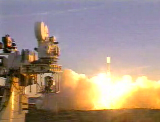
Jason-1 launch images
Published:
September 13, 2010
Jason-1 launch images
ENLARGE
Related
Oceans' Role in Climate - Jason-1
Oceans' Role in Climate - Jason-1
Jason-3 Ready for Launch
Jason-3 Ready for Launch
OSTM/Jason-2 Radiometer Antenna
OSTM/Jason-2 Radiometer Antenna
For NASA scientist Severine Fournier, studying our planet knows no borders.
"Science is International" Says French Sea Level Rise NASA Scientist
TOPEX/Poseidon Collecting Data
TOPEX/Poseidon Collecting Data
TOPEX/Poseidon LRA
TOPEX/Poseidon LRA
Poseidon-3 Altimeter
Poseidon-3 Altimeter
Jason-1 Radiometer
Jason-1 Radiometer
The SpaceX Falcon 9 rocket carrying the Sentinel-6 Michael Freilich spacecraft lifts off from Space Launch Complex 4 at Vandenberg Air Force Base in California, Nov. 21, 2020, at 9:17 a.m. PST
Sentinel-6 Launch
OSTM/Jason-2 Radiometer Antenna
OSTM/Jason-2 Radiometer Antenna
Sentinel-6 Michael Freilich will join a long-standing family of Earth observing satellites from NASA and European partners.
Sentinel-6 Michael Freilich Satellite Family Tree
Jason-3
Jason-3
Jason-1: TRSR instrument
Jason-1: TRSR instrument
The SpaceX Falcon 9 rocket carrying the Sentinel-6 Michael Freilich spacecraft lifts off from Space Launch Complex 4 at Vandenberg Air Force Base in California, Nov. 21, 2020, at 9:17 a.m. PST
Sentinel-6 Launch
Jason-1 readies for launch in its bay at Vandenberg, AFB (10/31/01)
Jason-1 readies for launch in its bay at Vandenberg, AFB (10/31/01)
TOPEX/Poseidon GPS
TOPEX/Poseidon GPS
Jason-1: First Image
Jason-1: First Image
OSTM/Jason-2 Artist's Concept
OSTM/Jason-2 Artist's Concept
These photos were taken during the Dual Payload Attach Fitting (DPAF) mating operation with Jason-1. (11/13/01) Photos: Scott Michel
These photos were taken during the Dual Payload Attach Fitting (DPAF) mating operation with Jason-1. (11/13/01) Photos: Scott Michel
Jason-1 readies for launch in its bay at Vandenberg, AFB (10/31/01)
Jason-1 readies for launch in its bay at Vandenberg, AFB (10/31/01)
Radiometer Installation Team - April 2007
Radiometer Installation Team - April 2007
OSTM/Jason-2 Line Drawing
OSTM/Jason-2 Line Drawing
TOPEX/Poseidon Artist's Concept
TOPEX/Poseidon Artist's Concept
Wind Speed
Wind Speed
TOPEX/Poseidon Launch
TOPEX/Poseidon Launch