NASA
Jet Propulsion Laboratory
California Institute of Technology
Skip Navigation
Ocean Surface Topography from Space
Stay Connected
menu
close modal
Resources
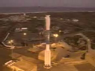
t - 12 minutes
Published:
September 13, 2010
t - 12 minutes
ENLARGE
Related
QuickTime VR of TOPEX/Poseidon
QuickTime VR of TOPEX/Poseidon
OSTM/Jason-2 Radiometer Antenna
OSTM/Jason-2 Radiometer Antenna
Launch preparations are progressing! (11/21/01) Photos: Stacy Mitchell of John Hopkins APL/TIMED project
Launch preparations are progressing! (11/21/01) Photos: Stacy Mitchell of John Hopkins APL/TIMED project
This artist's concept show Jason-3 over the Amazon.
Jason-3 over the Amazon
A key ocean observation satellite has been named after Earth scientist Michael Freilich
Ocean Satellite Renamed for Noted Scientist
Jason-3 Lifts Off!
Jason-3 Lifts Off!
Wind Speed
Wind Speed
These photos were taken during the Payload Attach Fitting (PAF) mating operation with Jason-1. (11/14/01) Photos: Scott Michel
These photos were taken during the Payload Attach Fitting (PAF) mating operation with Jason-1. (11/14/01) Photos: Scott Michel
OSTM/Jason-2 GPSP
OSTM/Jason-2 GPSP
TOPEX/Poseidon LRA
TOPEX/Poseidon LRA
Ocean Dynamic Topography
Ocean Dynamic Topography
TOPEX/Poseidon over Earth
TOPEX/Poseidon over Earth
The Antonov cargo aircraft carrying the Sentinel-6 Michael Freilich satellite touches down on the runway at Vandenberg Air Force Base in California on Sept. 24, 2020.
Sentinel-6 Spacecraft Arrival/Offload
t - 7 minutes - Photo: Tom Shain
t - 7 minutes - Photo: Tom Shain
TOPEX/Poseidon Radiometer
TOPEX/Poseidon Radiometer
Jason-1 Poster
Jason-1 Poster
OSTM/Jason-2 Spacecraft
OSTM/Jason-2 Spacecraft
Jason-1: LRA instrument
Jason-1: LRA instrument
TOPEX/Poseidon DORIS
TOPEX/Poseidon DORIS
TOPEX/Poseidon Artist's Concept
TOPEX/Poseidon Artist's Concept
Jason-1 Altimeter
Jason-1 Altimeter
TOPEX/Poseidon Poster (no text)
TOPEX/Poseidon Poster (no text)
This illustration shows the Sentinel-6 Michael Freilich spacecraft in orbit above Earth with its deployable solar panels extended.
Sentinel-6 Michael Freilich Artist's Rendering
t - 10 minutes
t - 10 minutes
SpaceX Falcon 9 rocket, topped with the Sentinel-6 Michael Freilich satellite secured inside its payload fairing, is rolled to Space Launch Complex 4
Sentinel-6 Rollout at SLC-4, VAFB