NASA
Jet Propulsion Laboratory
California Institute of Technology
Skip Navigation
Ocean Surface Topography from Space
Stay Connected
menu
close modal
Resources
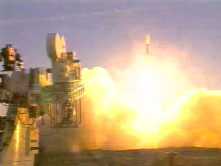
Jason-1 launch images
Published:
September 13, 2010
Jason-1 launch images
ENLARGE
Related
Jason-1: First Image
Jason-1: First Image
Jason-1 TRSR
Jason-1 TRSR
Jason-3 Launch
Jason-3 Launch
These photos were taken during the Payload Attach Fitting (PAF) mating operation with Jason-1. (11/14/01) Photos: Scott Michel
These photos were taken during the Payload Attach Fitting (PAF) mating operation with Jason-1. (11/14/01) Photos: Scott Michel
TOPEX/Poseidon over Earth
TOPEX/Poseidon over Earth
Ionospheric Total Electron Content
Ionospheric Total Electron Content
Wave Height
Wave Height
Jason-1 readies for launch in its bay at Vandenberg, AFB (10/31/01)
Jason-1 readies for launch in its bay at Vandenberg, AFB (10/31/01)
Watch the Jason-3 Science Briefing from Friday, Jan 15, 2016 - panelists discussed the science and research of the Jason-3 mission.
The Science of Jason-3
Jason-1: LRA instrument
Jason-1: LRA instrument
t - 7 minutes - Photo: Tom Shain
t - 7 minutes - Photo: Tom Shain
OSTM/Jason-2 LRA
OSTM/Jason-2 LRA
Jason-1 Launch - Artists Concept
Jason-1 Launch - Artists Concept
This is an artist's concept of the Sentinel-6 Michael Freilich spacecraft.
Artist's concept of Sentinel-6 Michael Freilich
Jason-3
Jason-3
Jason-1 in full flight configuration
Jason-1 in full flight configuration
Jason-1 readies for launch in its bay at Vandenberg, AFB (10/31/01)
Jason-1 readies for launch in its bay at Vandenberg, AFB (10/31/01)
Sea Level
Sea Level
The ocean-observing Sentinel-6 Michael Freilich satellite launched from Vandenberg Air Force Base in California aboard a SpaceX Falcon 9 rocket on Nov. 21, 2020 at 12:17 p.m. EST
NASA and SpaceX Launch U.S.-European Mission to Monitor World's Ocean (Recap)
SpaceX Falcon 9 Rocket
SpaceX Falcon 9 Rocket
The joint U.S.-European Sentinel-6 Michael Freilich is the next in a line of Earth-observing satellites that will collect the most accurate data yet on sea level and how it changes over time. With ...
New U.S.-European Satellite Tracking Sea Level Rise
Water Vapor
Water Vapor
TOPEX/Poseidon Mission to Planet Earth
TOPEX/Poseidon Mission to Planet Earth
Sea Surface Height
Sea Surface Height
Radiometer Rework - April 2007
Radiometer Rework - April 2007