NASA
Jet Propulsion Laboratory
California Institute of Technology
Skip Navigation
Ocean Surface Topography from Space
Stay Connected
menu
close modal
Resources
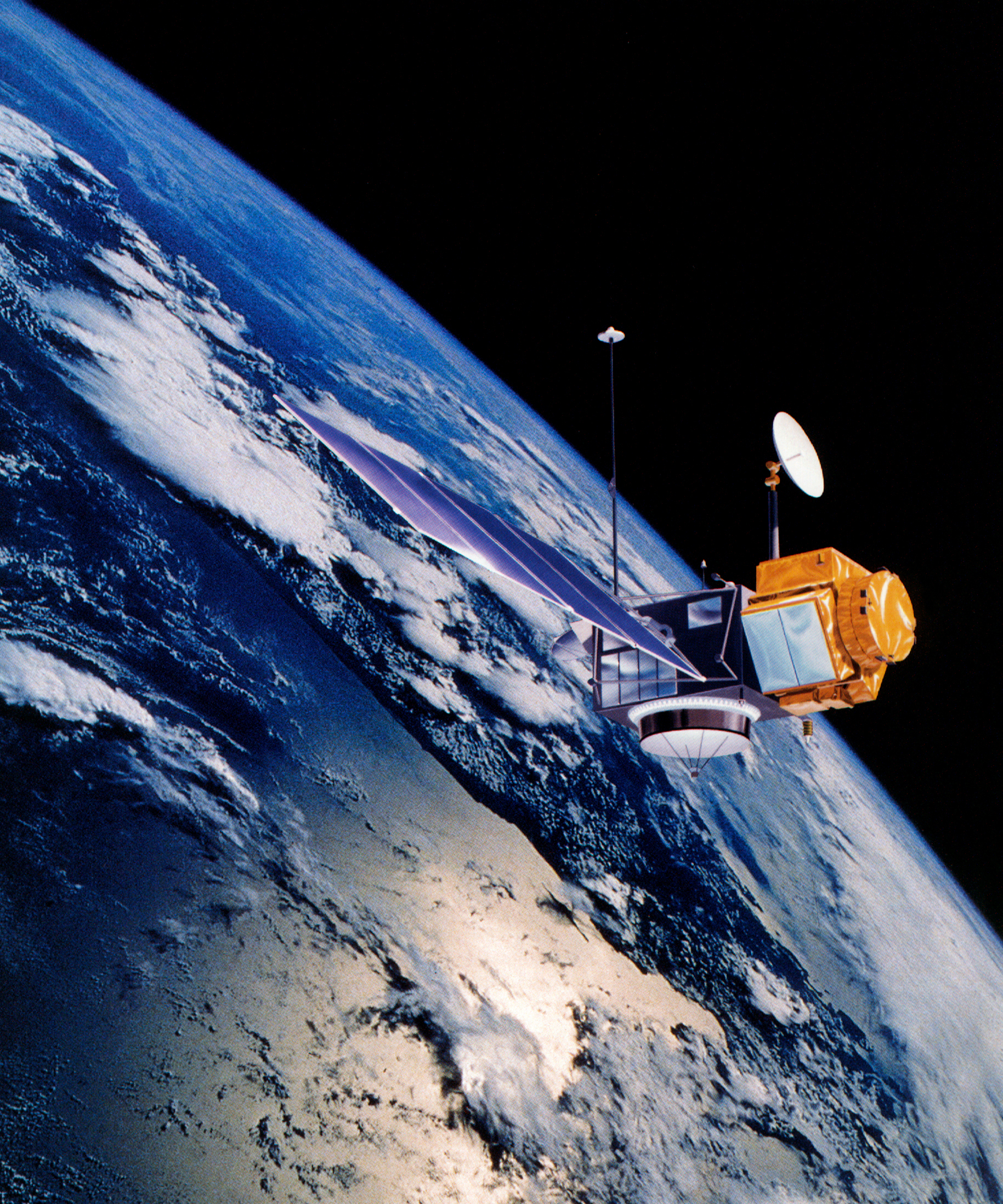
TOPEX/Poseidon over Earth
Published:
September 13, 2010
TOPEX/Poseidon over Earth
ENLARGE
Related
OSTM/Jason-2 Radiometer Antenna
OSTM/Jason-2 Radiometer Antenna
Sea Level
Sea Level
These photos were taken during the Payload Attach Fitting (PAF) mating operation with Jason-1. (11/14/01) Photos: Scott Michel
These photos were taken during the Payload Attach Fitting (PAF) mating operation with Jason-1. (11/14/01) Photos: Scott Michel
NASA and its U.S. and international partners have teamed up to launch a new Earth-observing satellite called Sentinel-6B that will measure sea surface height of most of the planet’s ocean. These ob...
Sentinel-6B: Extending the Legacy
TOPEX/Poseidon Altimeter
TOPEX/Poseidon Altimeter
The SpaceX Falcon 9 rocket, topped with the Sentinel-6 Michael Freilich satellite secured inside its payload fairing, is rolled to Space Launch Complex 4
Sentinel-6 Rollout at SLC-4, VAFB
OSTM/Jason-2 GPSP
OSTM/Jason-2 GPSP
This artist's concept show Jason-3 over the Amazon.
Jason-3 over the Amazon
Jason-1 Spacecraft Animation
Jason-1 Spacecraft Animation
High Resolution Jason-1 launch images
High Resolution Jason-1 launch images
OSTM/Jason-2 Spacecraft
OSTM/Jason-2 Spacecraft
These photos were taken during the Dual Payload Attach Fitting (DPAF) mating operation with Jason-1. (11/13/01) Photos: Scott Michel
These photos were taken during the Dual Payload Attach Fitting (DPAF) mating operation with Jason-1. (11/13/01) Photos: Scott Michel
TOPEX/Poseidon Poster (no text)
TOPEX/Poseidon Poster (no text)
Jason-3 Ready for Launch
Jason-3 Ready for Launch
Jason-3 Satellite Prepared For Launch
Jason-3 Satellite Prepared For Launch
These photos were taken during the Dual Payload Attach Fitting (DPAF) mating operation with Jason-1. (11/13/01) Photos: Scott Michel
These photos were taken during the Dual Payload Attach Fitting (DPAF) mating operation with Jason-1. (11/13/01) Photos: Scott Michel
Jason-1 atop the Delta II Photo: Tom Shain
Jason-1 atop the Delta II Photo: Tom Shain
This artist's concept show Jason-3 over France.
Jason-3 over France
TOPEX/Poseidon Collecting Data
TOPEX/Poseidon Collecting Data
Ariane 42P launch vehicle
Ariane 42P launch vehicle
Poseidon-3 Altimeter
Poseidon-3 Altimeter
The Antonov cargo aircraft carrying the Sentinel-6 Michael Freilich satellite touches down on the runway at Vandenberg Air Force Base in California on Sept. 24, 2020.
Sentinel-6 Spacecraft Arrival/Offload
Jason-1 launch images
Jason-1 launch images
Radiometer Installation Team - April 2007
Radiometer Installation Team - April 2007
TOPEX/Poseidon launch
TOPEX/Poseidon launch