NASA
Jet Propulsion Laboratory
California Institute of Technology
Skip Navigation
Ocean Surface Topography from Space
Stay Connected
menu
close modal
Resources
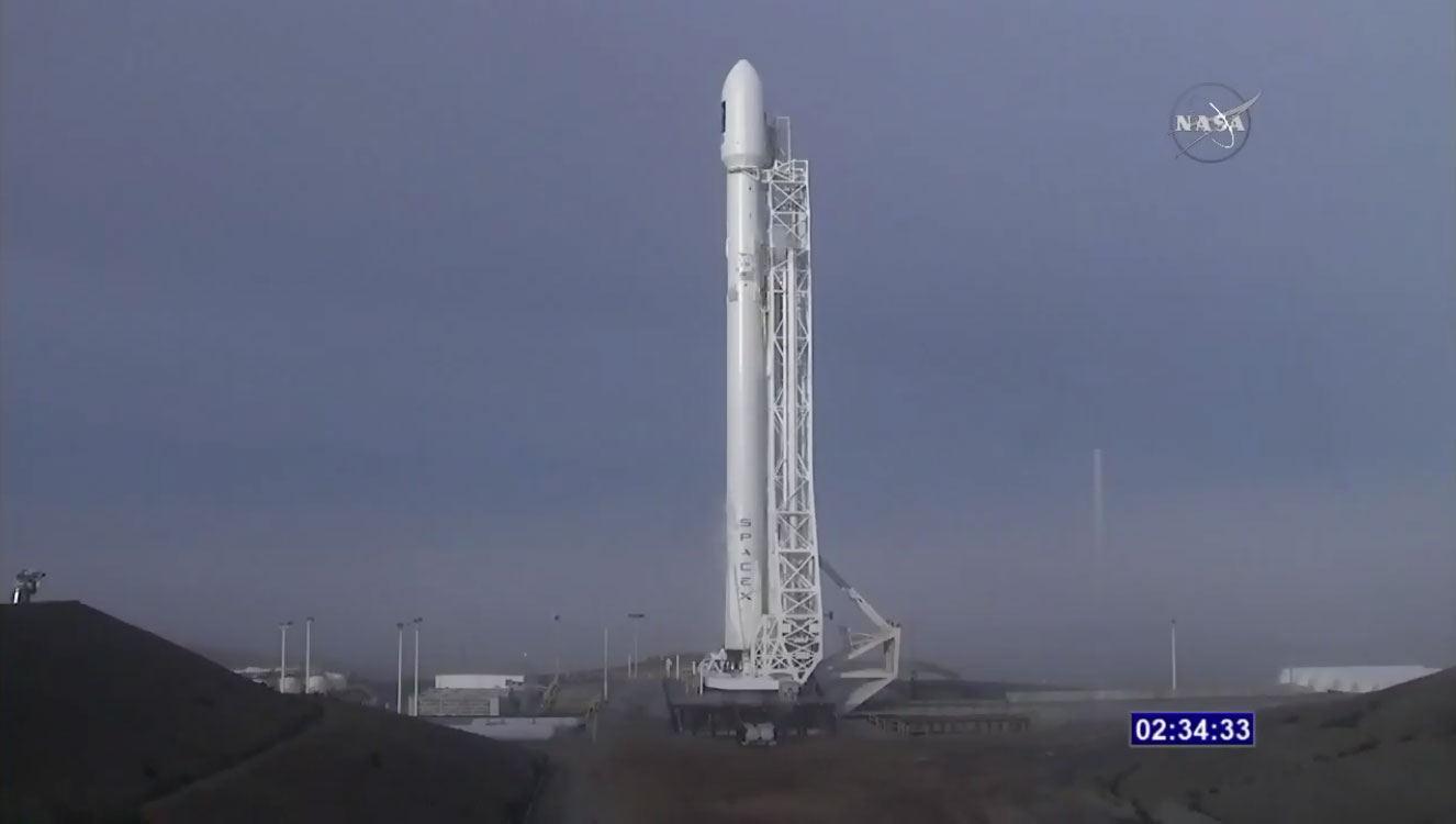
Jason-3 Ready for Launch
Published:
January 17, 2016
Jason-3 Ready for Launch
ENLARGE
Related
TOPEX/Poseidon GPS
TOPEX/Poseidon GPS
SpaceX Falcon 9 Rocket
SpaceX Falcon 9 Rocket
This illustration shows the Sentinel-6 Michael Freilich spacecraft in orbit above Earth with its deployable solar panels extended.
Sentinel-6 Michael Freilich Artist's Rendering
For NASA JPL engineer Parag Vaze, studying Earth’s rising ocean has been a career three decades in the making.
NASA Engineer Observes Sea Level Rise from Space for 30 Years
Jason-1 launch images
Jason-1 launch images
The Antonov cargo aircraft carrying the Sentinel-6 Michael Freilich satellite touches down on the runway at Vandenberg Air Force Base in California on Sept. 24, 2020.
Sentinel-6 Spacecraft Arrival/Offload
These photos were taken during the Payload Attach Fitting (PAF) mating operation with Jason-1. (11/14/01) Photos: Scott Michel
These photos were taken during the Payload Attach Fitting (PAF) mating operation with Jason-1. (11/14/01) Photos: Scott Michel
This is an artist's concept of the Sentinel-6 Michael Freilich spacecraft.
Artist's concept of Sentinel-6 Michael Freilich
This artist's concept show Jason-3 over the Amazon.
Jason-3 over the Amazon
Wind Speed
Wind Speed
High Resolution Jason-1 launch images
High Resolution Jason-1 launch images
TOPEX/Poseidon Artist's Concept
TOPEX/Poseidon Artist's Concept
TOPEX/Poseidon Poster (no text)
TOPEX/Poseidon Poster (no text)
OSTM/Jason-2 Radiometer Antenna
OSTM/Jason-2 Radiometer Antenna
Ionospheric Total Electron Content
Ionospheric Total Electron Content
The Sentinel-6 Michael Freilich satellite sits in front of a testing chamber where mission team members tested whether the spacecraft could endure the loud sounds it will encounter during launch.
Testing of Sentintel-6 Michael Freilich satellite
Jason-1 Poster
Jason-1 Poster
The Antonov cargo aircraft carrying the Sentinel-6 Michael Freilich satellite touches down on the runway at Vandenberg Air Force Base in California on Sept. 24, 2020.
Sentinel-6 Spacecraft Arrival/Offload
Jason-1 readies for launch in its bay at Vandenberg, AFB (10/31/01)
Jason-1 readies for launch in its bay at Vandenberg, AFB (10/31/01)
Jason-1 readies for launch in its bay at Vandenberg, AFB (10/31/01)
Jason-1 readies for launch in its bay at Vandenberg, AFB (10/31/01)
These photos were taken during the Payload Attach Fitting (PAF) mating operation with Jason-1. (11/14/01) Photos: Scott Michel
These photos were taken during the Payload Attach Fitting (PAF) mating operation with Jason-1. (11/14/01) Photos: Scott Michel
OSTM/Jason-2 Artist's Concept
OSTM/Jason-2 Artist's Concept
These photos were taken during the Payload Attach Fitting (PAF) mating operation with Jason-1. (11/14/01) Photos: Scott Michel
These photos were taken during the Payload Attach Fitting (PAF) mating operation with Jason-1. (11/14/01) Photos: Scott Michel
OSTM/Jason-2 GPSP
OSTM/Jason-2 GPSP
Inside half of the Delta Clam shell faring
Inside half of the Delta Clam shell faring