NASA
Jet Propulsion Laboratory
California Institute of Technology
Skip Navigation
Ocean Surface Topography from Space
Stay Connected
menu
close modal
Resources
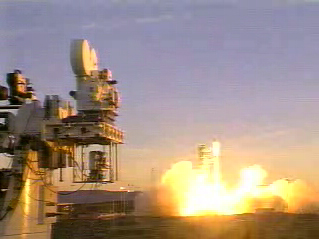
Jason-1 launch images
Published:
September 13, 2010
Jason-1 launch images
ENLARGE
Related
t - 7 minutes - Photo: Tom Shain
t - 7 minutes - Photo: Tom Shain
Wave Height
Wave Height
OSTM/Jason-2 Artist's Concept
OSTM/Jason-2 Artist's Concept
Poseidon-3 Altimeter
Poseidon-3 Altimeter
OSTM/Jason-2 GPSP
OSTM/Jason-2 GPSP
Jason-1 launch images
Jason-1 launch images
Launch preparations are progressing! (11/21/01) Photos: Stacy Mitchell of John Hopkins APL/TIMED project
Launch preparations are progressing! (11/21/01) Photos: Stacy Mitchell of John Hopkins APL/TIMED project
OSTM/Jason-2 Spacecraft
OSTM/Jason-2 Spacecraft
Mike Davis in front of the faring
Mike Davis in front of the faring
The SpaceX Falcon 9 rocket carrying the Sentinel-6 Michael Freilich spacecraft lifts off from Space Launch Complex 4 at Vandenberg Air Force Base in California, Nov. 21, 2020, at 9:17 a.m. PST
Sentinel-6 Launch
Jason-3
Jason-3
Sentinel-6 Michael Freilich will join a long-standing family of Earth observing satellites from NASA and European partners.
Sentinel-6 Michael Freilich Satellite Family Tree
Headed for Orbit!
Headed for Orbit!
TOPEX/Poseidon LRA
TOPEX/Poseidon LRA
Ionospheric Total Electron Content
Ionospheric Total Electron Content
High Resolution Jason-1 launch images
High Resolution Jason-1 launch images
Recorded live broadcast of Sentinel-6B, launched at 9:21 p.m. PST, Sunday, Nov. 16 (12:21 a.m. EST, Monday, Nov. 17) aboard a SpaceX Falcon 9 rocket from Vandenberg Space Force Base in California.
Relive the Launch: Sentinel-6B
Applications of Spaceborne Altimetry
Applications of Spaceborne Altimetry
Whale Census and Habitat
Whale Census and Habitat
Jason-1: TRSR instrument
Jason-1: TRSR instrument
Experts from NASA, ESA, EUMETSAT, and NOAA discuss the upcoming launch of Sentinel-6 Michael Freilich in a recorded live broadcast
News Update on Launch of the Sea Level-Monitoring Satellite, Sentinel-6 Michael Freilich
Jason-1 Launch - Artists Concept
Jason-1 Launch - Artists Concept
Jason-1 Spacecraft Animation
Jason-1 Spacecraft Animation
Jason-1 launch images
Jason-1 launch images
For NASA scientist Severine Fournier, studying our planet knows no borders.
"Science is International" Says French Sea Level Rise NASA Scientist