NASA
Jet Propulsion Laboratory
California Institute of Technology
Skip Navigation
Ocean Surface Topography from Space
Stay Connected
menu
close modal
Resources
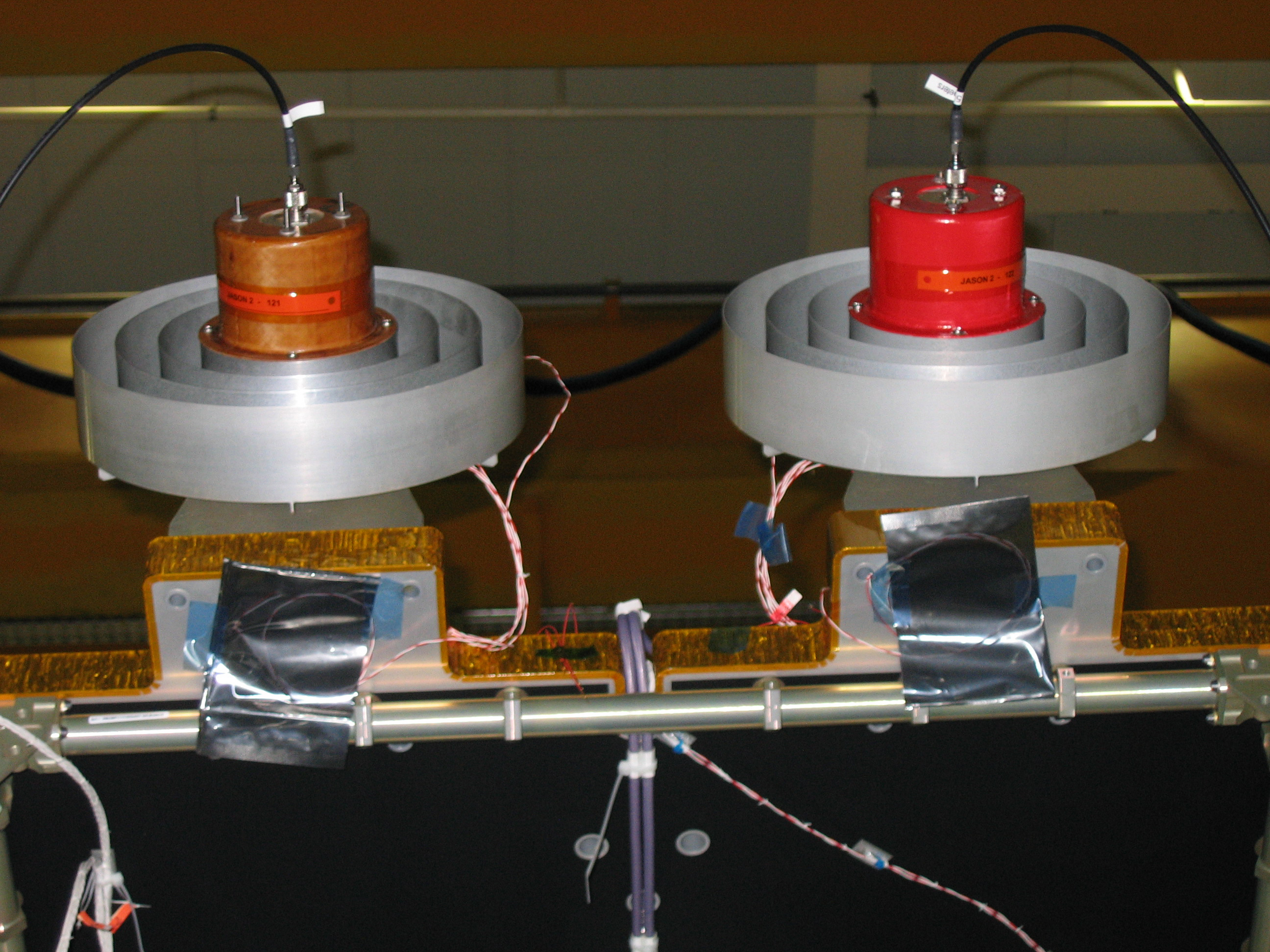
OSTM/Jason-2 GPSP
Published:
September 13, 2010
OSTM/Jason-2 GPSP
ENLARGE
Related
This artist's concept show Jason-3 over the Amazon.
Jason-3 over the Amazon
t - 7 minutes - Photo: Tom Shain
t - 7 minutes - Photo: Tom Shain
Early morning at the launch pad
Early morning at the launch pad
Launching aboard the joint U.S.-European Sentinel-6 Michael Freilich satellite is NASA’s next instrument that will help improve weather forecasting.
Using GPS to Improve Weather Forecasts
Sea Level
Sea Level
TOPEX/Poseidon DORIS
TOPEX/Poseidon DORIS
Sea Surface Height
Sea Surface Height
TOPEX/Poseidon Radiometer
TOPEX/Poseidon Radiometer
Radiometer Rework - April 2007
Radiometer Rework - April 2007
Launch preparations are progressing! (11/21/01) Photos: Stacy Mitchell of John Hopkins APL/TIMED project
Launch preparations are progressing! (11/21/01) Photos: Stacy Mitchell of John Hopkins APL/TIMED project
Launch preparations are progressing! (11/21/01) Photos: Stacy Mitchell of John Hopkins APL/TIMED project
Launch preparations are progressing! (11/21/01) Photos: Stacy Mitchell of John Hopkins APL/TIMED project
TOPEX/Poseidon LRA
TOPEX/Poseidon LRA
t - 12 minutes
t - 12 minutes
OSTM/Jason-2 Radiometer Antenna
OSTM/Jason-2 Radiometer Antenna
SpaceX Falcon 9 Rocket
SpaceX Falcon 9 Rocket
Jason-3
Jason-3
Ocean Dynamic Topography
Ocean Dynamic Topography
Jason-1 launch images
Jason-1 launch images
The Antonov cargo aircraft carrying the Sentinel-6 Michael Freilich satellite touches down on the runway at Vandenberg Air Force Base in California on Sept. 24, 2020.
Sentinel-6 Spacecraft Arrival/Offload
TOPEX/Poseidon over Earth
TOPEX/Poseidon over Earth
OSTM/Jason-2 Radiometer Antenna
OSTM/Jason-2 Radiometer Antenna
Jason-1: JMR instrument
Jason-1: JMR instrument
Mission team members perform acoustic tests of the Sentinel-6 Michael Freilich satellite in a chamber outfitted with giant speakers that blast the spacecraft with sound. This is to ensure that the ...
Testing of Sentinel-6 Michael Freilich satellite
Jason-3 Launch
Jason-3 Launch
The Falcon 9 protective payload fairing containing the Sentinel-6 Michael Freilich satellite
Payload fairing containing the Sentinel-6 Michael Freilich satellite