NASA
Jet Propulsion Laboratory
California Institute of Technology
Skip Navigation
Ocean Surface Topography from Space
Stay Connected
menu
close modal
Resources
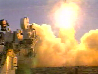
Jason-1 launch images
Published:
September 13, 2010
Jason-1 launch images
ENLARGE
Related
Jason-1 readies for launch in its bay at Vandenberg, AFB (10/31/01)
Jason-1 readies for launch in its bay at Vandenberg, AFB (10/31/01)
TOPEX/Poseidon LRA
TOPEX/Poseidon LRA
SpaceX Falcon 9 rocket, topped with the Sentinel-6 Michael Freilich satellite secured inside its payload fairing, is rolled to Space Launch Complex 4
Sentinel-6 Rollout at SLC-4, VAFB
The joint U.S.-European Sentinel-6 Michael Freilich is the next in a line of Earth-observing satellites that will collect the most accurate data yet on sea level and how it changes over time. With ...
New U.S.-European Satellite Tracking Sea Level Rise
Launch preparations are progressing! (11/21/01) Photos: Stacy Mitchell of John Hopkins APL/TIMED project
Launch preparations are progressing! (11/21/01) Photos: Stacy Mitchell of John Hopkins APL/TIMED project
These photos were taken during the Dual Payload Attach Fitting (DPAF) mating operation with Jason-1. (11/13/01) Photos: Scott Michel
These photos were taken during the Dual Payload Attach Fitting (DPAF) mating operation with Jason-1. (11/13/01) Photos: Scott Michel
Jason-1 Artists Concept
Jason-1 Artists Concept
Radiometer Rework - April 2007
Radiometer Rework - April 2007
OSTM/Jason-2 GPSP
OSTM/Jason-2 GPSP
Jason-1 LRA
Jason-1 LRA
Water Vapor
Water Vapor
OSTM/Jason-2 Line Drawing
OSTM/Jason-2 Line Drawing
Early morning at the launch pad
Early morning at the launch pad
Jason-3 Lifts Off!
Jason-3 Lifts Off!
Jason-3
Jason-3
Wind Speed
Wind Speed
Jason-1 atop the Delta II Photo: Tom Shain
Jason-1 atop the Delta II Photo: Tom Shain
This artist's concept shows Jason-3 over the California coast.
Jason-3 over California
TOPEX/Poseidon Altimeter
TOPEX/Poseidon Altimeter
Jason-3
Jason-3
Ocean Dynamic Topography
Ocean Dynamic Topography
The Antonov cargo aircraft carrying the Sentinel-6 Michael Freilich satellite touches down on the runway at Vandenberg Air Force Base in California on Sept. 24, 2020.
Sentinel-6 Spacecraft Arrival/Offload
Sentinel-6 Michael Freilich Launch footage
Sentinel-6 Michael Freilich Launch Footage
Jason-3 Launch
Jason-3 Launch
TOPEX/Poseidon over Earth
TOPEX/Poseidon over Earth