Resources
Jason-3 Begins Mapping the Ocean
Launched on January 17, 2016, Jason-3 is a partnership that includes NOAA, NASA, CNES, and EUMETSAT. After launch, Jason-3 was maneuvered into orbit about 80 seconds behind Jason-2, where it collected data at essentially the same time and place. It remained in this tandem orbit for about six months while scientists and engineers take a careful look at any differences between Jason-2 and Jason-3.
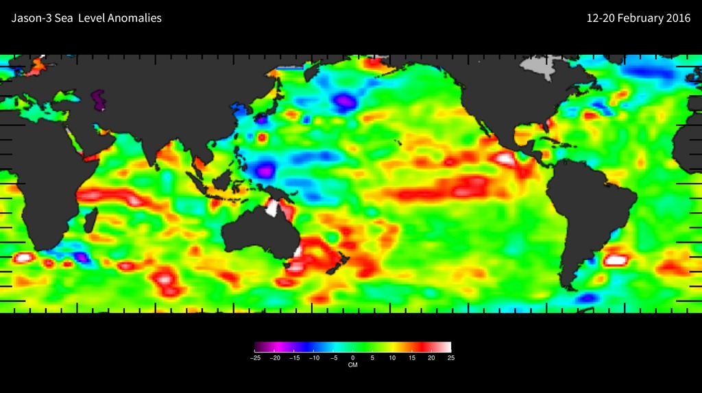
The map shown here was generated using sea surface height measurements from the first 10 days (February 12-20, 2016) of data collected once Jason-3 reached its operational orbit of 830 miles (1336 kilometers). The map corresponds well to data from its predecessor, Jason-2. Higher-than-normal sea levels are red; lower-than-normal sea levels are blue. El Niño is visible as the red blob in the eastern equatorial Pacific.
Extending the timeline of ocean surface topography measurements begun by the Topex/Poseidon and Jason-1 and Jason-2 satellites; Jason-3 will make highly detailed measurements of sea-level on Earth to monitor climate change and track phenomena like El Niño. It will also enable more accurate weather, ocean, and climate forecasts, including helping global weather and environmental agencies more accurately forecast the strength of tropical cyclones.
