NASA
Jet Propulsion Laboratory
California Institute of Technology
Skip Navigation
Ocean Surface Topography from Space
Stay Connected
menu
close modal
Resources
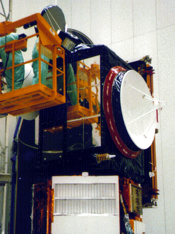
TOPEX/Poseidon Altimeter
Published:
September 13, 2010
TOPEX/Poseidon Altimeter
ENLARGE
Related
The Sentinel-6 Michael Freilich satellite sits in front of a testing chamber where mission team members tested whether the spacecraft could endure the loud sounds it will encounter during launch.
Testing of Sentintel-6 Michael Freilich satellite
Spacecraft processing
Sentinel-6 Michael Freilich spacecraft processing
Jason-1 readies for launch in its bay at Vandenberg, AFB (10/31/01)
Jason-1 readies for launch in its bay at Vandenberg, AFB (10/31/01)
t - 10 minutes
t - 10 minutes
High Resolution Jason-1 launch images
High Resolution Jason-1 launch images
Launch preparations are progressing! (11/21/01) Photos: Stacy Mitchell of John Hopkins APL/TIMED project
Launch preparations are progressing! (11/21/01) Photos: Stacy Mitchell of John Hopkins APL/TIMED project
Jason-1 Radiometer
Jason-1 Radiometer
Jason-1 launch images
Jason-1 launch images
Jason-3 Launch
Jason-3 Launch
TOPEX/Poseidon LRA
TOPEX/Poseidon LRA
Jason-3 Ready for Launch
Jason-3 Ready for Launch
High Resolution Jason-1 launch images
High Resolution Jason-1 launch images
Bringing Satellite Data Down to Earth
Bringing Satellite Data Down to Earth
Jason-1 launch images
Jason-1 launch images
TOPEX/Poseidon Collecting Data
TOPEX/Poseidon Collecting Data
This illustration shows the Sentinel-6 Michael Freilich spacecraft in orbit above Earth with its deployable solar panels extended.
Sentinel-6 Michael Freilich Artist's Rendering
OSTM/Jason-2 Artist's Concept
OSTM/Jason-2 Artist's Concept
Jason-3 Lifts Off!
Jason-3 Lifts Off!
The Antonov cargo aircraft carrying the Sentinel-6 Michael Freilich satellite touches down on the runway at Vandenberg Air Force Base in California on Sept. 24, 2020.
Sentinel-6 Spacecraft Arrival/Offload
OSTM/Jason-2 Radiometer Antenna
OSTM/Jason-2 Radiometer Antenna
OSTM/Jason-2 GPSP
OSTM/Jason-2 GPSP
TOPEX/Poseidon DORIS
TOPEX/Poseidon DORIS
The Antonov cargo aircraft carrying the Sentinel-6 Michael Freilich satellite touches down on the runway at Vandenberg Air Force Base in California on Sept. 24, 2020.
Sentinel-6 Spacecraft Arrival/Offload
These photos were taken during the Payload Attach Fitting (PAF) mating operation with Jason-1. (11/14/01) Photos: Scott Michel
These photos were taken during the Payload Attach Fitting (PAF) mating operation with Jason-1. (11/14/01) Photos: Scott Michel
Jason-1: First Image
Jason-1: First Image