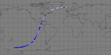
For nearly three decades, satellites have observed sea level change across the globe. Below are links to data from current and past altimeter missions used to understand the oceans.
-
After an extensive effort by teams at JPL and CNES, data from the first precision altimeter, TOPEX/Poseidon, has been reprocessed to modern standards.
-
Near Real Time along track Sea Surface Height residuals
-
Near-Real-Time along track Sea Surface Height residuals
-
Data for NASA-SSH products provide coherent and consistent time series of Sea Surface Height (SSH) from multi-mission altimeter data that meets the most stringent accuracy requirements. This provides credible mean sea level estimates for climate research. See related datasets from JPL MEaSUREs data projects.
-
Half degree, 7 day grids, 1950-Jun-16 to 2009-Jun-27, combining satellite altimetry with tide gages.
-
Altimeter data are used:
- As input into dynamic models for long term climate forecasting and prediction,
- To improve the knowledge of ocean tides and develop global tide models,
- To monitor the variation of global mean sea level and its relationship to changes in ocean mass and heat content, and
- To map the general circulation variability of the ocean, including the ocean mesoscale, over decades and in near real-time using multi-satellite altimetric sampling.
Other complementary data sources include sea surface temperature measurements from satellites, and in-situ measurements from buoys and drifters. For NASA's altimetry missions, taking measurements and turning them into usable scientific data products involves ground-based verification of the satellite measurements, an elaborate satellite telecommunications system for transmitting and receiving the data from its instruments, and a complex data processing effort involving two NASA centers, the French space agency, CNES, and our partners at NOAA and EUMETSAT.
Data from these missions are delivered to customers in map or digital form. Data products are generated for:
- Sea surface height
- Geostrophic velocity vectors
- Wind speed
- Wave Height

