Why Study the Ocean?
Satellite observations of the ocean over the past three decades have truly revolutionized our understanding of global climate change through measurements and modeling of the ocean-atmosphere climate system. Global data sets of ocean surface topography available on time scales of hours to decades have been and will continue to be a vital resource for scientists, commercial partners, and policy makers in fields like oceanography, meteorology, ocean commerce, and disaster mitigation.
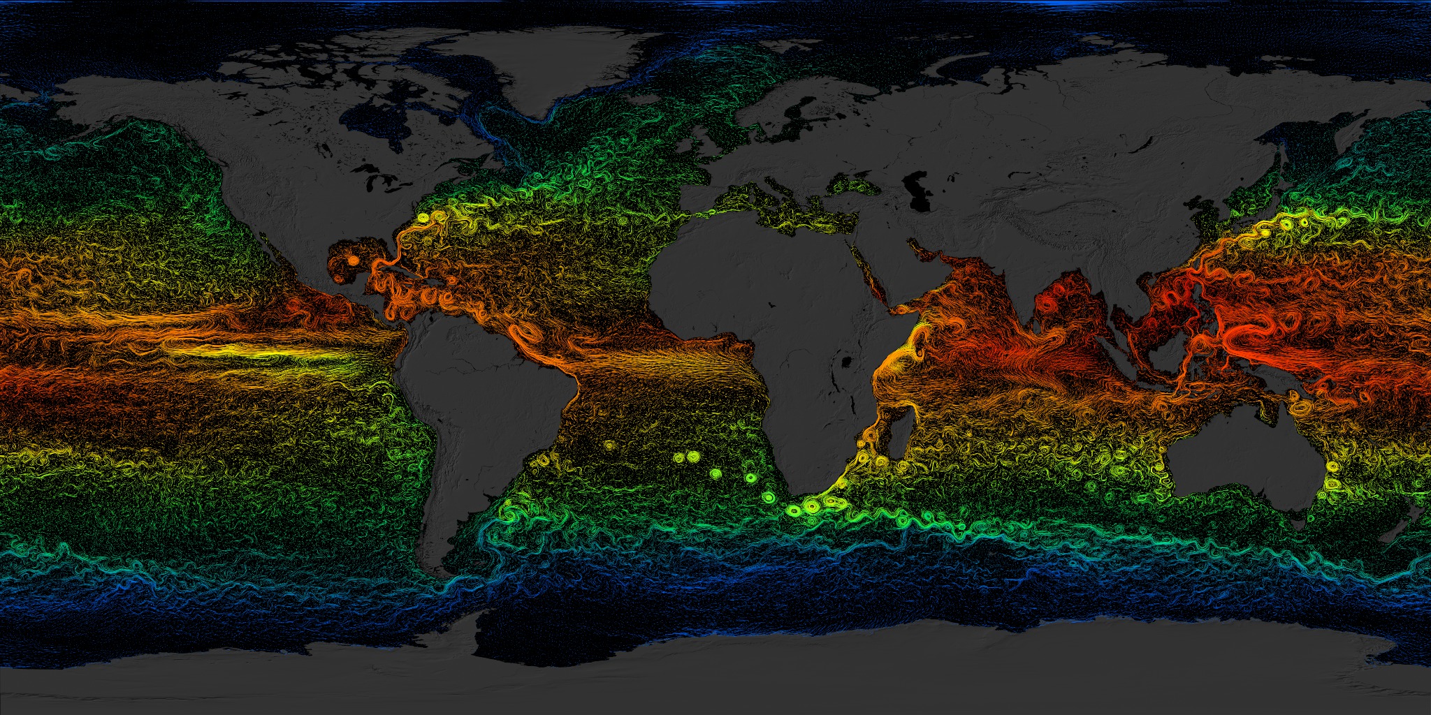
The nearly three decades of ocean altimetry observations have contributed to many fundamental advances in understanding global ocean circulation and its role in climate. The seasonal changes of ocean surface topography are mapped globally. These represent the most fundamental climate changes that ocean-atmosphere coupled models must be able to simulate before they are useful in other applications. Forecasting models have benefited from the data by improving the ability to predict events such as El Niño climate cycles. New understanding has been gained on the nature of long-period ocean waves that transmit climate signals across ocean basins. The best models for the tides in open ocean have been constructed using these measurements, and have led to the discovery of the role of tides in deep ocean mixing, an important factor in determining the patterns of large-scale ocean circulation. The mean sea level of the ocean, a key indicator of global climate change, is being monitored using ocean altimetry measurements.
Additionaly, there have been many social and economic benefits:
- Climate Research: By modeling changes in the distribution of heat in the ocean, scientists can study the evolution of weather patterns from the ocean system.
- Hurricane Forecasting: Altimeter and scatterometer data are incorporated into atmospheric models for hurricane season forecasting and individual storm severity.
- El Niño & La Niña Forecasting: Understanding the pattern and effects of climate cycles such as El Niño helps predict and mitigate the disastrous effects of floods and drought.
- Ship Routing: Maps of currents, eddies, and vector winds are used in commercial shipping and recreational yachting to optimize routes.
- Offshore Industries: Cable-laying vessels and offshore oil operations require accurate knowledge of ocean circulation patterns to minimize impacts from strong currents.
- Fisheries Management: Satellite data identify ocean eddies which bring an increase in organisms that comprise the marine food web, attracting fish and fishermen.
- Marine Mammal Research: Sperm whales, fur seals, and other marine mammals can be tracked and studied around ocean eddies where nutrients and plankton are abundant.
- Coral Reef Research: Remotely sensed data are used to monitor and assess coral reef ecosystems, which are sensitive to changes in ocean temperature.

Look through the Societal Benefits to discover more about some of these important practical and scientific uses of ocean altimetry data.