News | August 10, 2022
Happy 30th Anniversary to TOPEX/Poseidon!
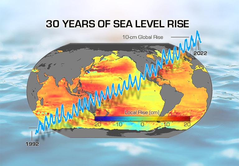
The image shows a map of how sea levels have changed over the last 30 years, with yellow areas rising slowly and red areas rising more quickly. Superimposed over the map is the record of global sea level change, which shows a 10 cm rise over the past 30 years. The natural, yearly cycle of global sea level change is also visible, with sea levels going up and down by about 1 cm each year as water is evaporated from the oceans and rains down over land.
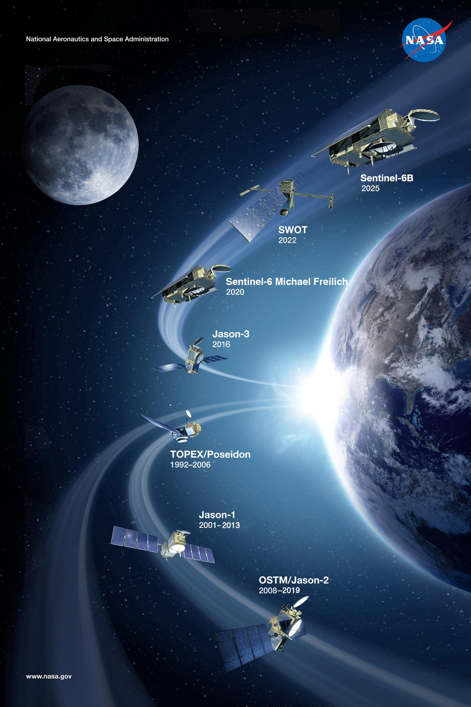
TOPEX/Poseidon delivered an astonishing 13+ years of data from orbit. The mission ended in January 2006. In those 13 years, it:
- Measured sea levels with unprecedented accuracy to better than 5 cm
- Continuously observed global ocean topography
- Monitored effects of currents on global climate change and produced the first global views of seasonal changes of currents
- Monitored large-scale ocean features like Rossby and Kelvin waves and studied such phenomena as El Niño, La Niña, and the Pacific Decadal Oscillation
- Mapped basin-wide current variations and provided global data to validate models of ocean circulation
- Mapped year-to-year changes in heat stored in the upper ocean
- Produced the most accurate global maps of tides ever
- Improved our knowledge of Earth's gravity field
NASA Earth Observatory - Tracking 30 Years of Sea Level Rise
Where were you when TOPEX/Poseidon launched?
A few fond memories from the altimetry community

 TOPEX/Poseidon Launch.
Image courtesy of Dudley Chelton (photographer unknown)