News | May 13, 2020
Using Jason data to monitor river height
Dr. Faisal Hossain, professor of civil and environmental engineering at the University of Washington, uses remotely-sensed Earth observing data as an integral resource in his work helping developing nations in South and Southeast Asia address challenges of limited water, food, and energy against a backdrop of accelerated economic development.
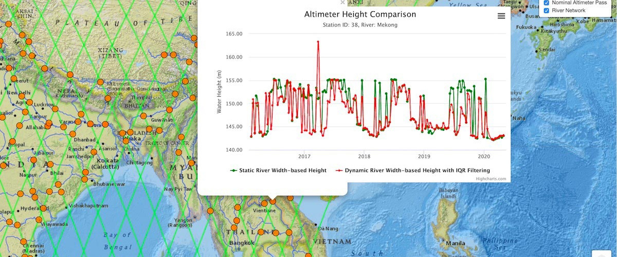
One example is Dr. Hossain and his colleagues altimeter height extraction technique for dynamically changing rivers of South and South-East Asia. Their SASWE Dynamic River Width based Altimeter Height Visualizer application is shown for the Mekong River, which supports the livelihood of more than 60 million people. The green line is static river height based only on near real-time Jason-3 altimeter data, and the red line is river height inferred by combining Jason-3 with near real-time Sentinel-1 synthetic aperture radar (SAR) imagery to identify the width and location of the dynamic river.
Additional Information:
- Data in Action: A River Runs Through It - Observation and Management
- Read the NASA Earth Data User profile to learn more about this study lead, Dr. Faisal Hossain from the University of Washington
- Get more information about NASA’s Applications.
Source: PO.DAAC