News | November 11, 2016
La Nada, For Now
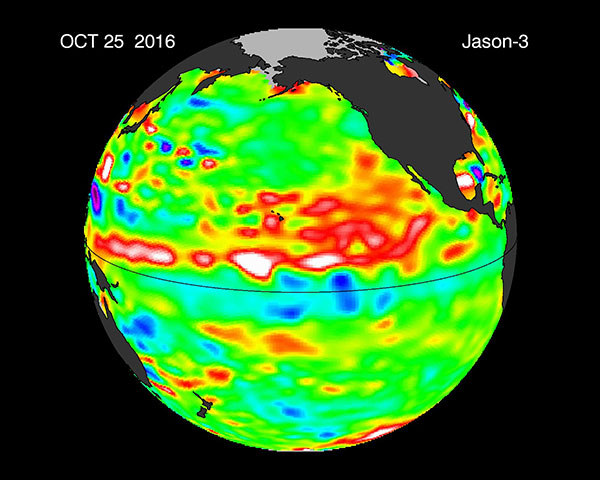
The Jason-3 satellite has been providing ocean surface topography data since March 2016--only two months after launch. The image below is the second Jason-3 image to be posted on the ‘El Niño/La Niña Watch Data’ site. “The transition from Jason-2 seems seamless,” says Bill Patzert, climatologist at NASA’s Jet Propulsion Laboratory. The latest data indicates that La Niña may be emerging across the Central Equatorial Pacific, but in both sea surface temperature (SST) and sea surface height (SSH) the La Nina signal is weak.
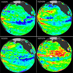
As Jan Null from Golden Gate Weather Services points out, “Unlike those picture puzzles where you are asked to find subtle differences between images, a look at the NASA sea surface height anomaly images for the past three weak La Niñas (1995, 2000, 2011) plus this year (2016), leaves little doubt that what's going on in the eastern Pacific is not subtle at all. The most striking difference is the anomalous warm water from the equator to about 25 degrees north. This area warmed in conjunction with last year's very strong El Niño and may have contributed to the atypical winter along the west Coast of North America.”
More on Jason-3 and El Niño
More on the Jason series ocean surface topography missions