by Margaret Srinivasan, NASA/Jet Propulsion Laboratory
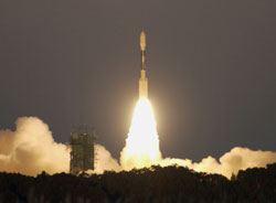
This month the Jason-1 mission completes its 10th year measuring the surface height of the global ocean. Launched December 7, 2001, Jason-1 continues an extended mission collecting detailed sea-surface topography data.
A joint NASA--French Centre Nationale d'Etudes Spatiales (CNES) endeavor, Jason-1 is the successful follow-on to the pioneering TOPEX/Poseidon mission, which revolutionized our understanding of the dynamics of ocean circulation and global climate. The sea-surface height measurements begun by TOPEX/Poseidon in 1992 were carried on by Jason-1. In 2008, the meteorological agencies of the USA and Europe collaborated with NASA and CNES to launch the Ocean Surface Topography Mission/Jason-2 satellite to build upon this unprecedented long-term record of consistent, continuous global observations of Earth's ocean.
The Jason missions do not collect their observations in isolation. A National Oceanic and Atmospheric Administration (NOAA)-led ocean profiling float project called Argo1 was created to collect in situ observations of the ocean surface and complement those obtained by the Jason missions. More recently, data from the Gravity Recovery and Climate Experiment (GRACE) has been combined with the altimetry data from Jason and Argo to give scientists a more complete picture of the changing ocean surface than ever before. The combination of data from these three sources has become an important global observing system for sea level and ocean circulation studies.
Early calibration phases of the missions allowed TOPEX/Poseidon and Jason-1, and now Jason-1 and Jason-2, to fly over identical ground tracks, providing unprecedented opportunities to cross-calibrate the spacecraft instruments to remove systematic errors. The resulting data streams have provided seamless coverage between the three missions. This coverage has allowed scientists to observe and study both short-lived events such as hurricanes and long-term climate phenomena such as El Niño, La Niña, and the Pacific Decadal Oscillation. It also provides the capability to closely monitor changes in global mean sea level, one of the most important indicators of human-caused climate change. Other significant science results from the mission include studies of ocean circulation, the ties between the ocean and the atmosphere, and improved global climate forecasts and predictions.
The Ocean Surface Topography Science Team looks forward to the launches of the operational Jason-series satellites. The first of these launches, Jason-3, is projected for 2014 with NOAA and Eumetsat leading the efforts, along with partners NASA and CNES. Concepts for Jason Continuity of Service (Jason-CS) and the Surface Water and Ocean Topography (SWOT) missions are also underway.
Related News Release - NASA's Jason-1 Achieves a One-Decade Landmark
1 The Array for Real-time Geostrophic Oceanography (ARGO) program is a collaboration between 50+ research and operational agencies from 45 countries. The name Argo was specifically chosen to denote the close connection between these two missions. The Greek mythological hero Jason embarked on his epic quest for the Golden Fleece on a ship called the Argo; his companions on the adventure were members of the crew—called Argonauts.