News | June 21, 2001
Pacific Remains Locked In Three-Year-Old Pattern: No El Niño Yet, But One Due

While change may be on the way, the Pacific is still dominated by the strong, larger-than-El Niño/La Niña pattern called the Pacific Decadal Oscillation (PDO), according to the latest data from the U.S.-French TOPEX/Poseidon satellite mission, managed by NASA's Jet Propulsion Laboratory, Pasadena, Calif. The PDO is a long-term ocean temperature fluctuation of the Pacific Ocean that waxes and wanes approximately every 10 to 20 years. "This continuing PDO pattern of the past three years signals more of the unusually dry conditions that have afflicted the North American west coast," said JPL oceanographer Dr. William Patzert.
The new satellite image, available at http://www.jpl.nasa.gov/images/earth/pacificocean, also shows a pulse of warm water traveling toward South America, a reminder that another El Niño is due in the next year or so. El Niños generally return every two to seven years; the last one occurred in 1997. This equatorial, eastward-traveling Kelvin wave (a bulge of warm water) is headed toward South America at about 140 degrees West longitude. In late July, when this wave arrives at the west coast of South America, there should be a modest warming of the eastern Pacific. Kelvin waves, often seen before an El Niño develops, are triggered by westerly wind bursts (i.e., winds blowing in the opposite direction from the normal easterly trade winds) in the western Pacific. Also, the strength of El Niño's next appearance could depend on how much the PDO dominates ocean circulation and temperature patterns over the next few years.
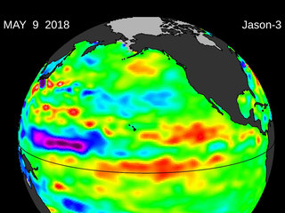
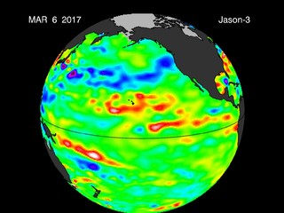
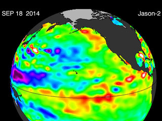
The data were taken during a 10-day collection cycle ending June 11, 2001. They show that the near-equatorial ocean has slowly warmed in the past year and sea levels and sea-surface temperatures are near normal. Above-normal sea-surface heights and warmer ocean temperatures (indicated by the red and white areas) still blanket the far-western tropical Pacific and much of the north and south mid-Pacific. Red areas are about 10 centimeters (4 inches) above normal; white areas show the sea-surface height is between 14 and 32 centimeters (6 to 13 inches) above normal.
In the Western Pacific, the build-up of heat, first noted by TOPEX/Poseidon oceanographers more than two years ago, has outlasted the La Niña of the past few years. See http://sealevel.jpl.nasa.gov/elnino/20000118.html. This warmth contrasts with the Bering Sea, Gulf of Alaska and U.S. West Coast where lower-than-normal sea surface levels and cool ocean temperatures continue (indicated by blue areas). The blue areas are between 5 and 13 centimeters (2 and 5 inches) below normal, whereas the purple areas range from 14 to18 centimeters (6 to 7 inches) below normal.
For now, these latest TOPEX/Poseidon data show that the entire Pacific basin continues to be dominated by the strong and stable PDO's characteristic warm horseshoe and cool wedge pattern. Most recent National Oceanic and Atmospheric Administration (NOAA) sea-surface temperature data also clearly illustrate the persistence of this basin-wide pattern. They are available at http://psbsgi1.nesdis.noaa.gov:8080/PSB/EPS/SST/climo.html.
"Given the three-year persistence of the PDO pattern, there will be a tendency to produce impacts similar to the past two summers with continuing drought and heat in the West," said Patzert. "In some parts of the West, this long-lasting drought has created considerable pain. In the Pacific Northwest, water supplies are dangerously low and temperatures should be up, which will exacerbate the energy crisis and, like the summer of 2000, we are set up for a very busy summer and fall fire season," said Patzert.
"Warm oceanic patterns in the North Pacific and tropical Atlantic suggest a more-active-than-normal hurricane season for the U.S. East and Gulf Coasts. The only good news in this is that the Gulf Coast and Florida could sure use the rainfall, but the danger is that it could come as the recent costly and painful deluge of tropical storm Allison," said Patzert.
The National Oceanic and Atmospheric Administration's (NOAA) National Weather Service U.S. winter forecast shows little relief for drought in the West, Southeast and Florida and a wet summer in the Midwest. NOAA seasonal forecasts can be found at http://www.noaanews.noaa.gov/stories/s647.htm.
The U.S.-French TOPEX/Poseidon mission is managed by JPL for NASA's Earth Science Enterprise, Washington, D.C. JPL is a division of the California Institute of Technology in Pasadena. For more information on the TOPEX/Poseidon project, see: http://topex-www.jpl.nasa.gov.


