Mission Basics
Sentinel-6
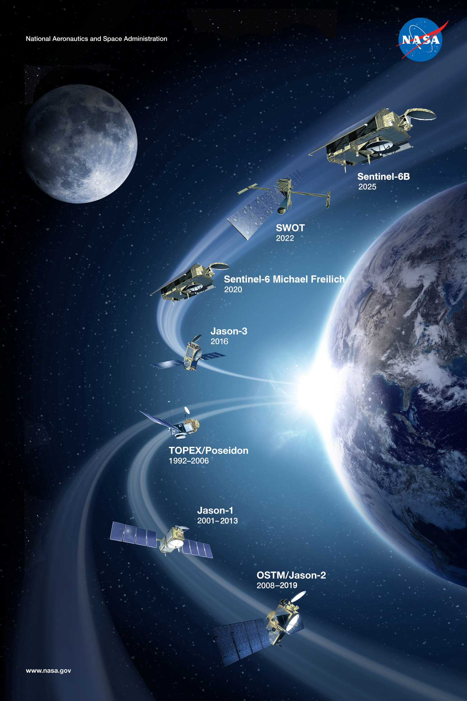
Sentinel-6 Michael Freilich
Launched: November 21, 2020
Sentinel-6 B
Launched: Sunday, November 16, 2025 (PST)
The Jason Continuity of Service (Jason-CS) mission on the Sentinel-6 spacecraft will carry the next generation of high-precision altimeters. This collaborative mission between the U.S. and Europe will consist of two identical satellites (named Michael Freilich and B), extending key ocean data records beyond three decades. Jason-CS/Sentinel-6 will also collect high-resolution vertical profiles of atmospheric temperature to support weather prediction.
Jason-3
Launched: January 17, 2016
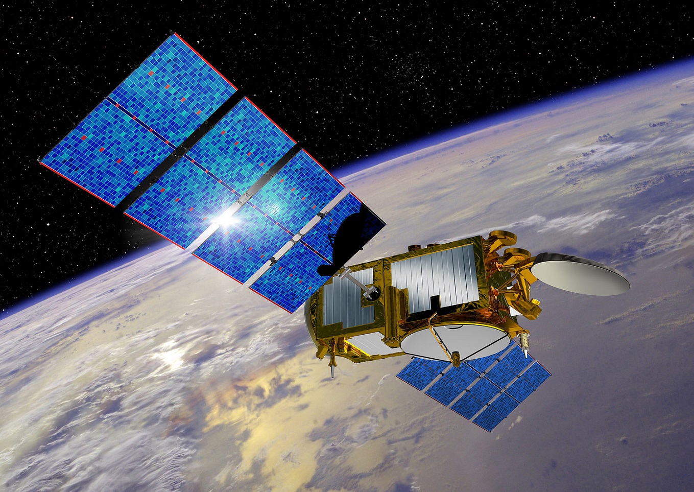
Jason-3 is the fourth mission in U.S.-European series of satellite missions that measure the height of the ocean surface. The mission is extending the time series of ocean surface topography measurements (the hills and valleys of the ocean surface) begun by the TOPEX/Poseidon satellite mission in 1992. These measurements provide scientists with critical information about circulation patterns in the ocean and about both global and regional changes in sea level and the climate implications of a warming world.
OSTM/Jason-2
Launched: June 20, 2008, Decommissioned: October 2019
OSTM/Jason-2 – The Ocean Surface Topography Mission on the Jason-2 satellite, was a follow-on to Jason-1. It took oceanographic studies of sea surface height into an operational mode for continued climate forecasting research and science and industrial applications.
Jason-1
Launched: December 7, 2001, Decommissioned: July 2013.
Jason-1 continued the task of providing the important oceanographic data time-series originated by TOPEX/Poseidon, carrying updated versions of the same instruments. It flew in tandem with TOPEX/Poseidon for 5 years.
TOPEX/Poseidon
Launched: August 10, 1992, Decommissioned: January 2006.
TOPEX/Poseidon data revolutionized the way the global ocean is studied. For the first time, the seasonal cycle and other temporal variabilities of the ocean were determined globally with high accuracy, yielding fundamentally important information for testing ocean circulation models. Major observations were made using TOPEX/Poseidon data on:
- Oceanic circulation including details on the movement of Rossby and Kelvin waves
- Oceanic and coastal tides
- El Niño, La Niña, and the Pacific Decadal Oscillation
- El Niño-like circulation in the Atlantic Ocean
- Oceanic seasons in the Mediterranean
- Ocean floor topography from surface data used to refine the geoid model
GRACE and GRACE-FO
Launched: March 17, 2002 and May 22, 2018
The Gravity Recovery and Climate Experiment (GRACE), flew two identical spacecraft approximately 220 kilometers apart in a polar orbit 500-kilometers above Earth. Between 2002 and 2017, GRACE data were used to produce monthly maps of the geoid, providing insights into water movement and ice mass change on Earth. Launched in 2018, the GRACE Follow-On mission (GRACE-FO), continued the time series.
The geoid is the theoretical surface of Earth that would coincide with mean sea level in the absence of all winds, currents, and tides. We can think of the geoid as one continuous set of small, horizontal 'planes'. It is perpendicular, at every point, to Earth’s gravity acceleration. In addition, GRACE/GRACE-FO time-varying data are a proxy for ocean bottom pressure, a quantity that, combined with sea surface height, allows a more accurate estimate of ocean heat content.
The GRACE missions are able to measure Earth’s gravity field with a level of precision that is at least 100 times greater than any previously existing methods, revealing the formerly hidden, finer details of the geoid. Because the TOPEX/Jason altimeters measure ocean surface topography with respect to this reference surface, GRACE’s highly-precise measurements of the geoid, mean a more accurate altimeter measurement of ocean surface topography.
SWOT
Launched: December 15, 2022
The Surface Water Ocean Topography mission is flying a radar interferometer that produces near-instantaneous images of sea surface height – differing from our other altimeters that only sample the nadir point, or the point on Earth directly below the satellite. The emphasis of SWOT is the shorter wavelengths of sea surface height in order to observe the fine details of the ocean's surface topography. In addition, SWOT will measure time changes in height of land water bodies.
Mission Details
The agreement in 1987 between CNES and NASA to join resources and expertise on the TOPEX/Poseidon project culminated 20 years of development into using a spaceborne radar altimeter to measure ocean-surface topography.
TOPEX/Poseidon was launched August 10, 1992 from the ESA launch facility at Kourou, French Guiana, aboard an Ariane 42P launch vehicle. TOPEX/Poseidon data revolutionized the way the global ocean is studied. For the first time, the seasonal cycle and other temporal variabilities of the ocean were determined globally with high accuracy, yielding fundamentally important information for testing ocean circulation models. Many major observations were made using TOPEX/Poseidon data.
Recognizing the importance of continuing ocean surface topography measurement, NASA and CNES flew Jason-1 as a joint follow-on to TOPEX/Poseidon. Many years of scientific discovery by TOPEX/Poseidon have broadened its original list of science objectives.
OSTM/Jason-2 was a collaborative NASA/CNES/NOAA/Eumetsat mission, launched as a follow-on to Jason-1. Each of the spacecraft carried 5 similar or identical instruments. On OSTM/Jason-2, the CNES-supplied spacecraft carried the payload of five instruments: the POSEIDON-3 dual frequency altimeter, the mission's main instrument which measures altitude; the Advanced Microwave Radiometer (AMR) to measure perturbations due to atmospheric water vapor; and the three location-finding systems: the DORIS Doppler orbitography beacon, the laser retroreflector array (LRA), and the Global Positioning System Payload (GPSP). These instruments were designed to provide measurements for at least 5 years. Jason-1 and OSTM/Jason-2 were launched from Vandenberg AFB aboard NASA-supplied Delta rockets, Jason-1 on December 7, 2001, and OSTM/Jason-2 on June 20, 2008.
After TOPEX/Poseidon was decommissioned in January 2006, for the next 11-1/2 years, Jason-1 continued the task of providing the important oceanographic data time-series originated by its predecessor. Jason-1 was decommissioned in July 2013, and OSTM/Jason-2 continued this important data into the third decade. OSTM/Jason-2 was decommissioned in October 2019.
OSTM/Jason-2 was integrated into numerous international climate-study programs, provided near real-time data access, and marked the beginning of the operational era of collecting these critical oceanographic parameters. The fourth mission in the altimeter series, Jason-3, launched January 17, 2016.
Where are they now?
Have you ever looked up in the night sky to see a satellite passing overhead? Have you wondered what satellite it was? Maybe it was Jason-3. You can find out! See where Jason-3 is right now.
To find out when you can view this satellite from your area, go to Heavens-Above and follow the directions below.
- Under Configuration, and “Current observing site”, select your location from their map or database. If you want to enter your coordinates manually, follow the instructions on the link, “edit manually”.
- Read the instructions and enter your town or village.
- If a list of towns are returned, select the correct one.
- Under Satellites, choose "Select a satellite from the database."
- In the Satellite Name: jason 3 for Jason-3.
- From the Satellite Search Results list, select the satellite.
- In the upper right of the page, select Passes to see when you can view the satellite from your location.


