RECAP24: REprocessed Coastal Altimetry Product, from Level 2 to Level 4
Author:
Marcello Passaro - (Deutsches Geodätisches Forschungsinstitut der Technischen Universität München (DGFI-TUM))
Co-Investigator(s):
Denise Dettmering (DGFI-TUM)
Gaia Piccioni (DGFI-TUM)
Abstract:
There has been an increasing interest towards satellite altimetry measurements in the coastal area and in recent years the scientific community has provided the first examples of dedicated products. These attempts have involved different areas of improvement, but it is still hard and time-consuming for non-expert users to combine the different tools into a higher level database suitable for sea level research.
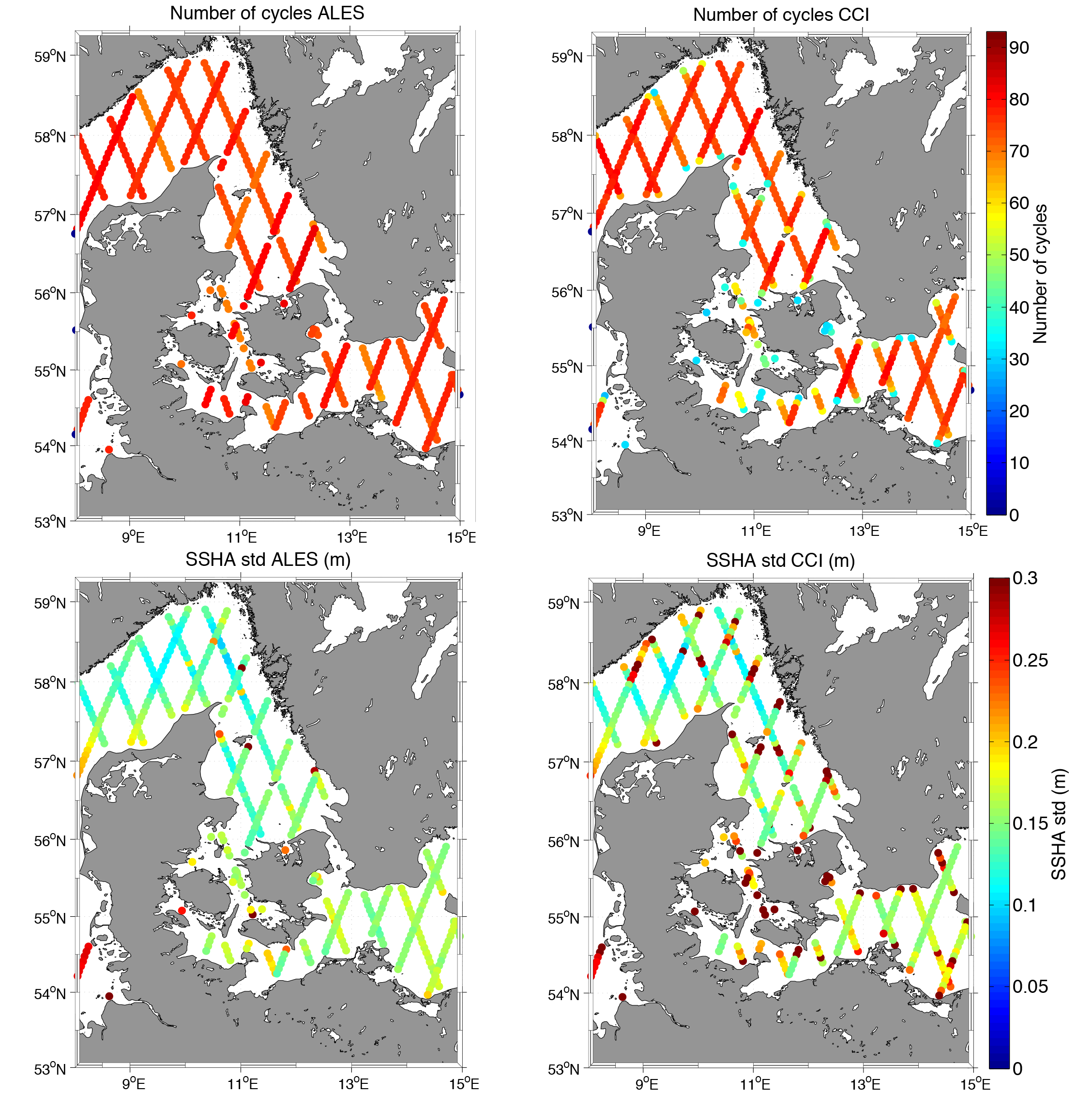
This proposal is focused on the production of a dedicated Level 3 and 4 coastal product based on the preprocessing of Level 1 waveform data by means of the ALES coastal retracker and on the postprocessing of the measurements by means of state-of-the-art geophysical corrections, agging and averaging procedures.
The ALES Level-1 preprocessing algorithm, already published and validated for Jason-1, Jason-2, Envisat and Saral missions, will be adapted to Jason-3 as well as to past altimetry missions (ERS-1 and ERS-2) in order to guarantee the continuity of service in the coastal zone and the expansion of the time series. In terms of the corrections to the retrieved raw sea level, particular attention will be given to a specific sea state bias correction and to the improvement of coastal ocean tide modelling.
Following the current availability of the DGFI-TUM Open Altimetry Data Base (OpenADB) platform, a Level-3 coastal sea level anomaly product and a Level-4 multi-mission gridded regional product will be produced as a final output. The project will help fostering the use of high-level coastal altimetry products and the interaction between the data providers and the end-users.