Global and regional altimetry CAL/VAL and science
Author:
Marc Naeije - (Delft University of Technology (TUDelft), Astrodynamics and Space missions / Dept. Space Engineering (AS/SpE))
Co-Investigator(s):
Ernst Schrama (Delft University of Technology - TU Delft)
Abstract:
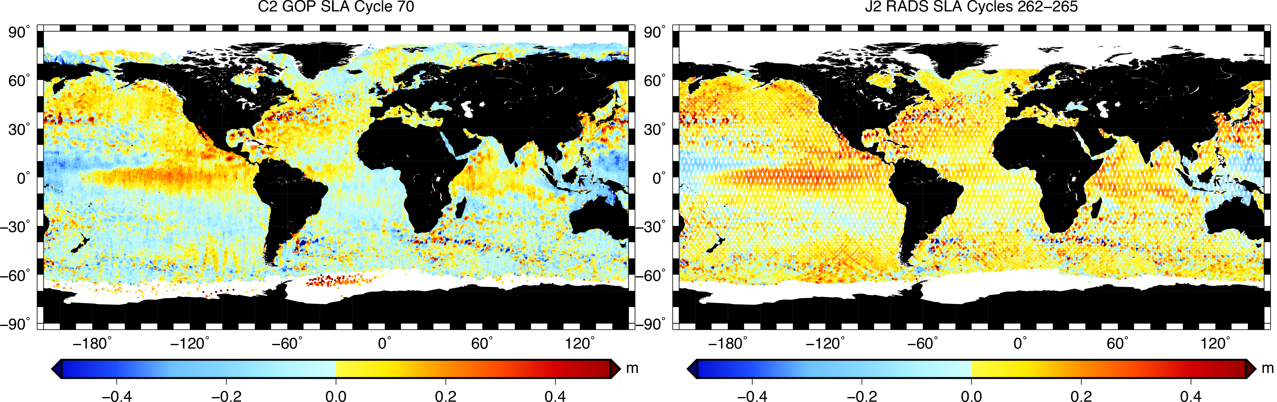
The research on ocean surface topography, as implemented at the Astrodynamics and Space missions Chair, Dept. of Space Engineering (AS/SpE) of TU Delft, focusses on CAL/VAL activities related to altimetry and gravimetric observations. This is an on-going activity at the department and elaborates on previous (OSTST/SWT) projects dealing with calibrating, validating, studying and applying data from all altimeter missions to date, now also including the JASON-3 and SENTINEL- 3 missions. Main topics include a) the maintenance, development and service of the Radar Altimeter Database System (RADS), b) the related altimeter calibration and validation issues and orbit accuracy assessment and improvement, c) the scientific use in multidisciplinary studies, combining altimetry with gravity data to improve circulation models, address water and ice mass changes, improve ocean tidal modelling, and enhance mesoscale variability, and d) the long-term global, regional and local sea level variation using a mix of altimetry and other information sources like GNSS, InSAR and tide gauges. Connected to the work for RADS we address the preparation for new altimeter missions and new altimeter concepts like SAR altimetry. Connected to CAL/VAL, sampling issues and strategies to optimally combine available and future altimetry is addressed as well.