Towards consistent regional sea level budgets
Author:
Jürgen Kusche - (Institut für Geodäsie und Geoinformation, IGG, Bonn University)
Co-Investigator(s):
Roelof Rietbroek (University of Bonn)
Luciana Fenoglio (University of Bonn)
Bernd Uebbing (University of Bonn)
Matthias Becker (Technical University Darmstadt)
Abstract:
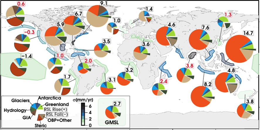
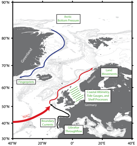
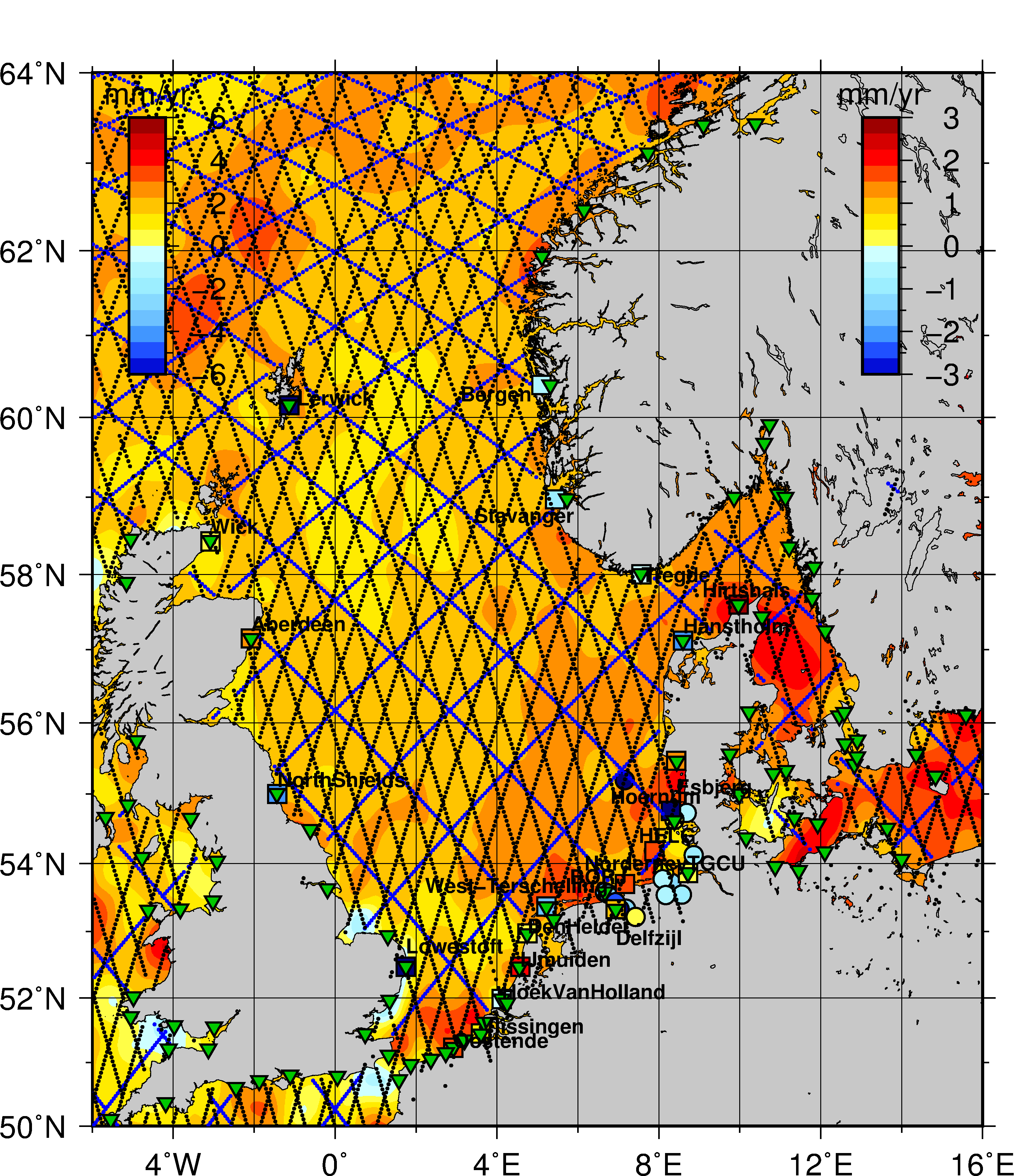
The proposed research addresses the use of radar altimetry data from the missions Jason-2 and 3, Envisat, SARAL/AltiKa, CryoSat-2, and Sentinel-3 for establishing regional sea level budgets, while respecting global mean sea level budgets. The project will improve both Conventional Altimeter (CA) and Delay Doppler Altimeter (DDA) data especially in the coastal zone of selected regions and combine these data with space gravimetry data from the GRACE and from the future GRACE-FO mission. It will also contribute to the preparation to future missions such as Sentinel-6/Jason-CS. The project will address specific research topics (1), (3), (5) and (8) as outlined in the Research Announcement. Target regions are (a) the global ocean and (b) selected coastal regions such as the high latitude regions in the north-east of Greenland, the North Sea and the Bay of Bengal. Addressing the global ocean in combination with the proposed regional refinements is necessary in order to guarantee the closure of the global sea level budget while allowing a consistent transition into the regions of interest.