
LAECOS: Lagrangian altimetry for open ocean environmental applications: ecological hotspots and contaminants' spreading
Author:
Francesco d’Ovidio - (LOCEAN)
Other participant(s) (France):
P. Testor, L. Mortier (LOCEAN-IPSL)
M. Lengaigne, J. Vialard (LOCEAN-IPSL, IRD)
P. Koubbi (UPMC)
C. Guinet, C. Bost, Y. Cherel (CEBC)
Other participant(s) (Abroad):
B. Fach (Erdemli Marine Station, Turkey)
Y. Lehahn (Weizman Inst., Israel)
H. Gildor (Jerusalem Univ., Israel)
C. Lopez, E. Hernandez-Garcia (Ifisc, Spain)
M. Hindell (IMAS, Australia)
Abstract:
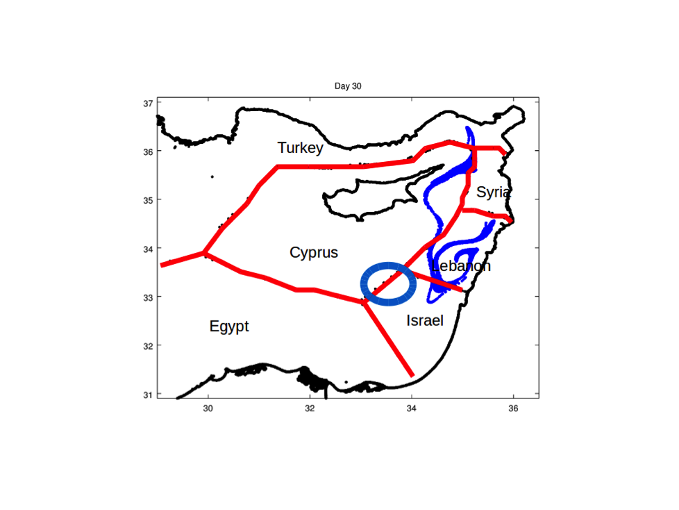
Lagrangian methods compute statistics on particle trajectories and have recently emerged as a powerful tool for extracting transport information from altimetry data. LAECOS addresses new perspectives on the development and assessment of Lagrangian altimetry for environmental applications. This project consists in a first theoretical part aimed at developing and validating altimetry-derived Lagrangian diagnostics for pollution and animal tracking applications. Lagrangian diagnostics will be developed and assessed over two paradigmatic studies: contaminant dispersion in the complex geopolitical environment of the Eastern Mediterranean (in international cooperation with Levantine countries); and identification of ecological hotspots in the Southern Ocean (in support to the ongoing project for an open ocean natural reserve east of Kerguelen). The results of this project will reach policy makers thanks to collaborations recently established with managing bodies (TAAF, CCAMLR) and regional institutions (Australia for the S. Ocean, Turkey and Israel for the Levantine). As a secondary objective, the development of Lagrangian diagnostics and their integration/comparison with environmental data (pollutants and animal tracking) will provide a “user level” validation of transport pathways derived for altimetry. This validation will likely unveil shortcomings that may be useful to know in the development of future products or missions.