Service activities at the Centre de Topographie des Océans et de l'Hydrosphère (CTOH)
Author:
Florence Birol - (LEGOS)
Co-Investigator(s):
Blarel, Fabien (LEGOS/CNRS )
Blumstein, Denis (LEGOS/CNES)
Fleury, Sara (LEGOS/CNRS )
Frappart, Frederic (LEGOS/CNAP )
Morrow, Rosemary (LEGOS/CNAP )
Niño, Fernando (LEGOS/IRD)
Abstract:
The CTOH is a French observation service dedicated to satellite altimetry, created in 1989 and supported by the CNRS, CNES, IRD and the Observatoire Midi Pyrenees. Its role is to facilitate access and use of altimetry data and products, and to observe and study the dynamics of the oceans, the cryosphere and the hydrosphere. The CTOH works closely with space agencies (CNES, ESA, NASA), and with major operational altimetry distribution centers, such as AVISO+. The latter provide "standard" data and products for most scientific and operational applications in the open ocean. The CTOH plays a complementary role by focusing on the needs of the zones and applications for which the "standard" altimetry products are not adapted (coastal ocean, continental hydrology, cryosphere, sea ice and open-ocean fine-scale processes). The CTOH also ensures a return of expertise to the operational departments and space agencies, ranging from preparatory studies for new altimetric missions to algorithmic transfer, and information on the changing needs of users.
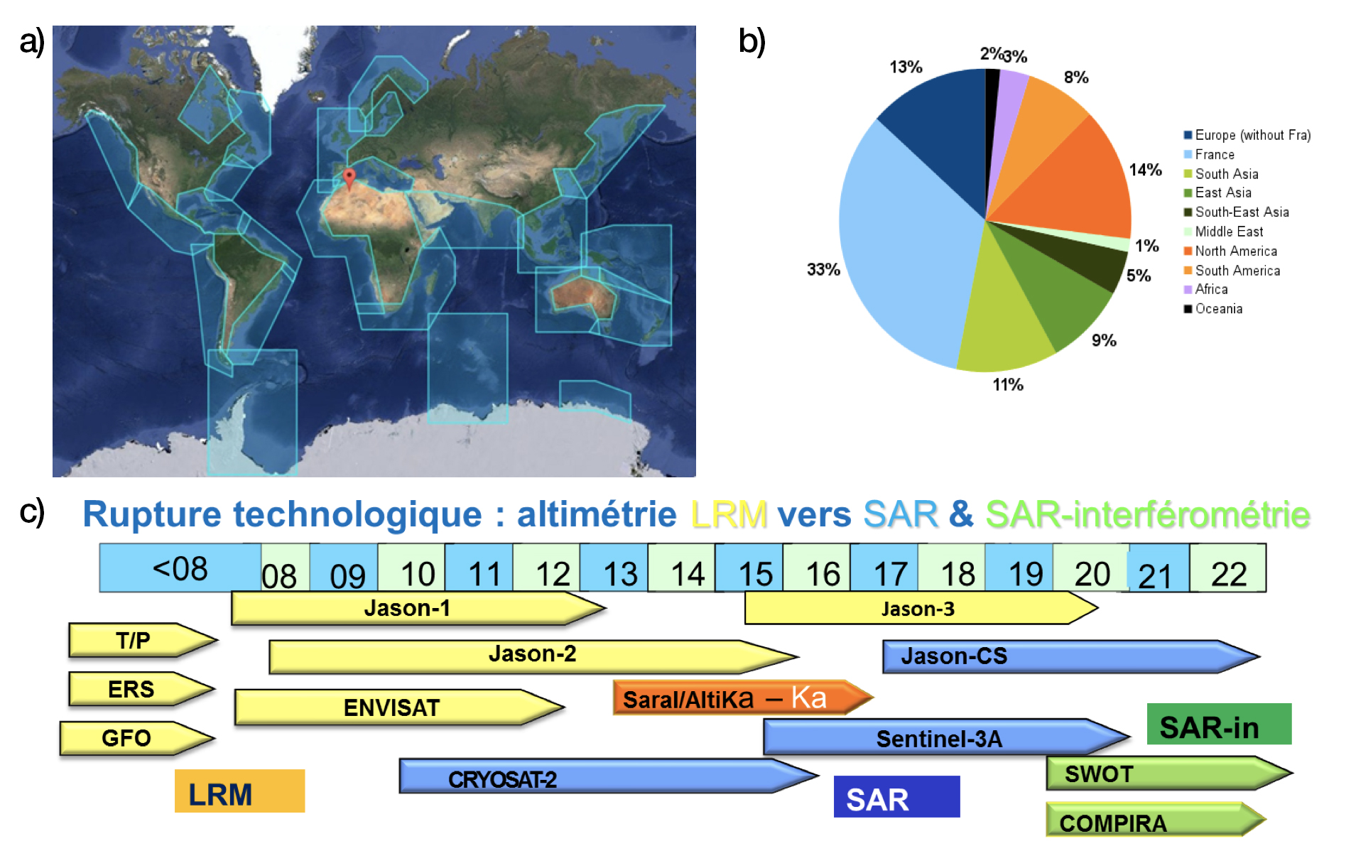
We help our users develop new products and altimetry applications, by providing a comprehensive altimetric GDR and SDR database (constantly evolving to meet their needs). We provide expertise and / or algorithms and software to exploit it, and an adapted training program when requested. The CTOH also develops its own derived altimetry products, in liaison with different research teams (national or foreign), validates them and then distributes them. These products exist over the coastal oceans (X-TRACK; Fig a)), terrestrial surface waters (MAPS), over the open ocean at fine scale, and over sea-ice. In turn, the users provide us with key expertise to help us evolve our databases and algorithms. Our main users are French and international scientific research groups, with strong demand from third-world users (see Figure b).
The long and precise altimetric series, with regular and global sampling, enable us today to monitor seasonal, interannual and long-term drifts in water and ice levels over all surfaces, in order to better understand the water cycle. During the Jason-3 period, the CTOH will continue to analyze the waveforms and derived height products from conventional altimetry like Jason-2 and -3, as well as new instruments based on the SAR technique (Cryosat-2, since 2010, Sentinel-3 in 2016) or in Ka-band (SARAL / AltiKa since 2013; see Figure c). They greatly improve the observation of the coastal ocean and continental surfaces. The CTOH is working on the preparation of future missions exploiting new technologies (Jason CS in SAR mode - 2020), as well as SAR - interferometric (SWOT - 2021), based on simulations and analyses of present missions. All of these new missions allow the observation of physical processes of finer scales (notably spatial). One of the major challenges for the CTOH in the coming years is to ensure the continuity between the altimetric technologies (on the different types of surface) and to support the users in the exploitation of the data resulting from the new missions. This involves adapting its databases and products, its operating and analysis algorithms, its distribution mode and training.