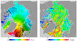
Mean sea surface, mean dynamic topography and arctic sea level variation
Author:
Ole Andersen - (Technical University of Denmark - Geodetic Department)
Co-Investigator(s):
Per Knudsen (DTU space)
Lars Stenseng (DTU space)
Stine K. Rose (DTU space)
Abstract:
The definition of “Global” wrt to MSL trend estimation presently ignores the Polar Regions and present pseudo “global” MSL trend calculated within 66º. These estimated must be extended to include all ocean areas, especially as the Polar Regions are currently the regions that experience the largest changes during the last 25 years.
DTU space has a long record for determining the Mean sea surface and deriving the mean dynamic topography for referencing of the satellite mission.
With the recent initiated drifting mission of Saral/AltiKA and the possible geodetic mission of Jason-2 we will have an unique opportunity to derive ultra-high resolution mean sea surface and gravity field on possible 30 second global grids. A large effort in reaching this goal is the scientific research toward improving the quality of the data in the region and extending the time-series.
We are currently investigating several methods to improve the quality of the altimetric data in non-open ocean areas like the coastal regions and the Arctic Ocean. One of the method is through retracking of particularly the Cryosat-2 SAR data. The output of this research should be both improved methods of retracking focusing on simplified waveform retracking of i.e., the leading edge, which in coastal regions and in the Arctic region has shown great potential for accurate sea level determination.
Major difference still exists in the near-coastal and shelf regions between “state of the art” global ocean tide models (i.e., GOT4.7, TPXO, DTU10, FES2004 etc). It is extremely important to improve ocean tide models for many reasons such as human safety, tidal science, tidal dissipation and mixing as well as sediment and nutrient transport. In the Arctic Ocean the number of accurate tide gauges are few, the presence of sea ice make the altimetric observations noisy and only sun-syncronous satellites are available which makes tidal prediction difficult, though a dedicated effort in improving global ocean tide models are very timely with this project.

